Germany’s AllSkyCAM UAP Research Program
Explore Germany AllSkyCAM UAP research program: how its camera network works, what it can identify, its evidence limits, and reporting tips.
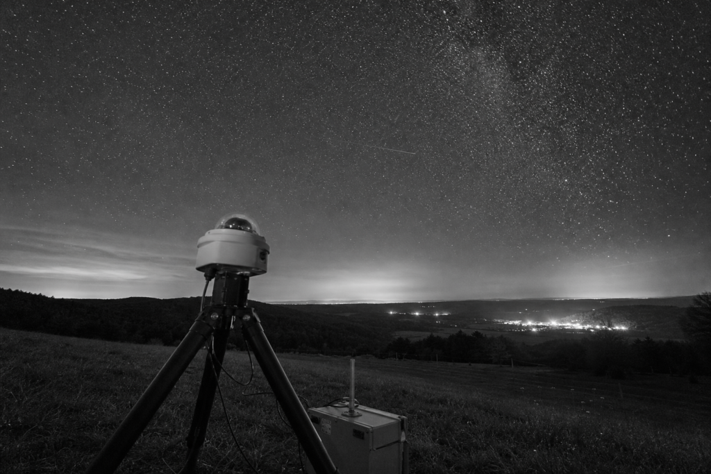
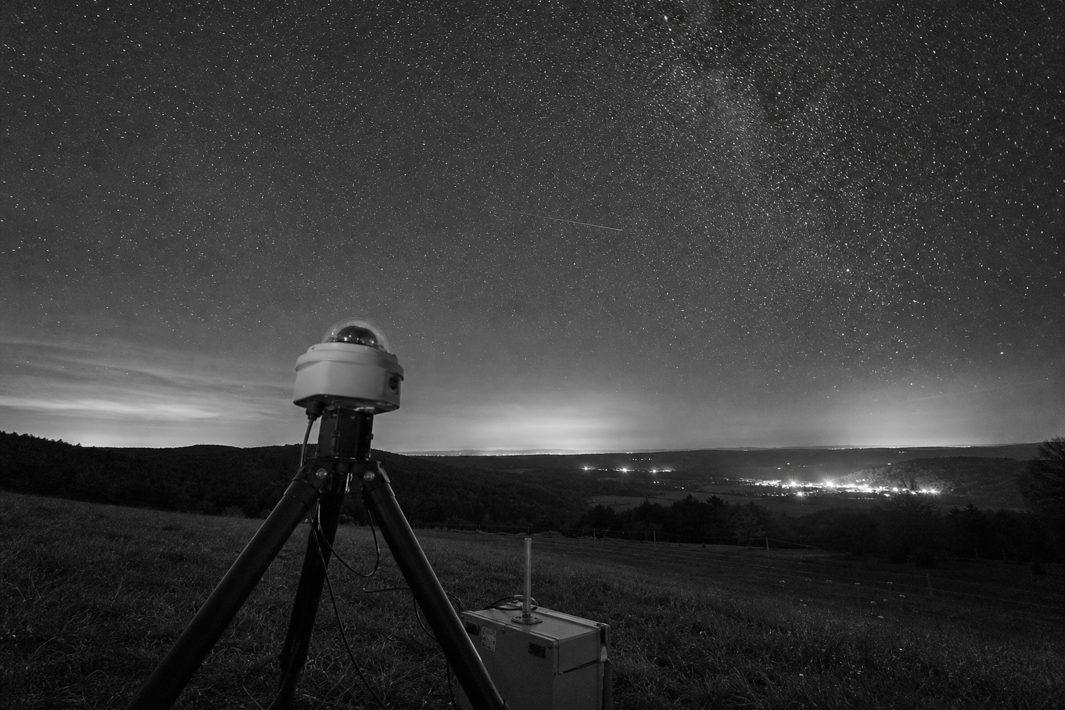
An unidentified aerial observation is a record that has not yet been explained; it is not, by itself, evidence of an extraordinary or non-human origin. That distinction makes systematic observation more useful than speculation. A short, isolated video of a light may appear unusual, but without its original file, an exact time and location, fixed reference points, or an independent view, it cannot reliably establish distance, speed, size, or identity.
Germany’s AllSkyCAM UAP research program is therefore worth examining as an evidence question rather than a conclusion. An all-sky camera is designed to image a broad area of sky; when records from two or more synchronized sites include calibration and timestamps, investigators can compare sightlines and potentially constrain an event’s position. Those additions make a record stronger than a reposted clip, yet they do not automatically identify an object or demonstrate non-human intelligence.
This article assesses AllSkyCAM on documented terms: its named operators and supporters, the proposed all-sky observation workflow, and the kinds of ordinary aerial or astronomical explanations that a preserved record may help test. It also separates detection from classification and explanation, sets limits on what optical data can show, and ends with practical steps, such as retaining original files and recording the precise viewing location, that can make a reported observation useful for later review.
What Germany’s AllSkyCAM UAP Research Program Is, and What It Is Not
As of 5 August 2026, the research material provided for this article identifies “AllSkyCAM” as a proposed all-sky observation effort, but supplies no dated official project statement naming an operator, launch date, station location, German federal ministry, Bundeswehr unit, or national UAP office. On that record, it cannot responsibly be described as a German government disclosure program, a military operation, or an official national investigation service.
The useful, narrower label is an observational project that could develop into a network: a project is the defined work of collecting and assessing records, while a network requires multiple linked observing sites. An initiative is broader still, covering people or institutions that may contribute sites, equipment, technical work, or review. Those categories describe organization and method; none establishes state ownership or official investigative authority.
Its stated evidentiary problem is practical: an unusual report is difficult to assess when it lacks an exact time, observing position, original recording, and independent comparison. A single camera can preserve the apparent path of a light; two synchronized sites can provide separate sightlines that may constrain where an event occurred. The second arrangement is stronger because it gives investigators something testable rather than relying on appearance alone.
That distinction also limits what AllSkyCAM Germany could establish. A preserved sequence may document an observation and support later identification, but it does not by itself determine an object’s identity, intent, or origin. Claims of government sponsorship, military status, or non-human intelligence require primary records beyond the material presently available for this Germany AllSkyCAM UAP research program.
Who Operates or Supports AllSkyCAM?
That evidentiary threshold applies equally to the people and organizations behind the work. The materials available for this article do not provide a dated primary project page, institutional profile, grant record, station directory, or partner list that names an AllSkyCAM operator, technical lead, host institution, funder, or participating observer.
It would therefore be premature to describe the AllSkyCAM UAP project as university-run, nonprofit-led, government-supported, or citizen-science operated. Those are materially different roles: a station host supplies a physical observing location; a network operator coordinates collection; a software maintainer controls processing tools; and an analyst evaluates whether a record supports a proposed identification. A collaborator may perform one role without controlling the whole network.
The same restraint applies to geographic claims. No substantiated current or historical station count, German site list, or cross-border coverage map is available in the record used here. A camera network’s claimed reach matters because separated, time-synchronized sites can potentially provide independent views of one event, whereas multiple cameras at one location mainly improve local coverage.
For readers assessing future descriptions of the German UAP camera network, the strongest organizational evidence would be dated names, institutional affiliations, defined responsibilities, deployment locations, and a clear statement of who retains and analyzes the data. Until such records are publicly attributable, AllSkyCAM’s operational support structure and coverage should be treated as unresolved rather than inferred from its title.
How the All-Sky Observation System Works
The missing technical record matters because an all-sky system is only as useful as the context attached to each image. No attributable materials supplied for this article establish AllSkyCAM’s camera model, lens field of view, capture cadence, spectral sensitivity, clock source, calibration routine, transfer method, or event-detection software. Those details should not be assumed from the project name.
In a well-designed all-sky camera workflow, a wide-angle lens records much of the sky from a fixed, surveyed position. The tradeoff is coverage against detail: a broader view is more likely to catch a transient event, while a narrower view can place more pixels on a distant target. Each frame needs a precise timestamp, the station coordinates, and preserved original files. Calibration then relates pixel positions to known directions in the sky and accounts for lens distortion, so an apparent path can be expressed as an observation angle rather than merely a streak on a screen.
Capture may be continuous or scheduled. Continuous recording reduces the chance of missing a brief event but produces a large review burden; scheduled imaging reduces storage and processing demands but can leave gaps. Automated motion or brightness screening can flag candidates, yet human review remains important because clouds, insects, sensor artifacts, and changing exposure can resemble motion.
The strongest geometry arises when separated stations record the same event with synchronized clocks. Each site supplies a line of sight; intersecting those lines can estimate position and trajectory, while timing can constrain motion. A single station generally yields only an angular track. Thus, all-sky camera UAP research gains most when records are calibrated, time-linked, and independently matched, not simply when a camera has captured an unusual light.
What AllSkyCAM Can Help Identify, and Filter Out
An apparent anomaly often becomes less anomalous when its path, timing, brightness pattern, and surrounding conditions are examined together. A brief, fast streak may fit a meteor; a steady track at a predicted time may fit a satellite pass; repeating navigation-like flashes or a route-consistent track may point toward an aircraft. A drone can be harder to classify optically because its visibility depends on range, lighting, size, and whether its lights are active, but a persistent low-altitude path can still supply useful exclusion clues.
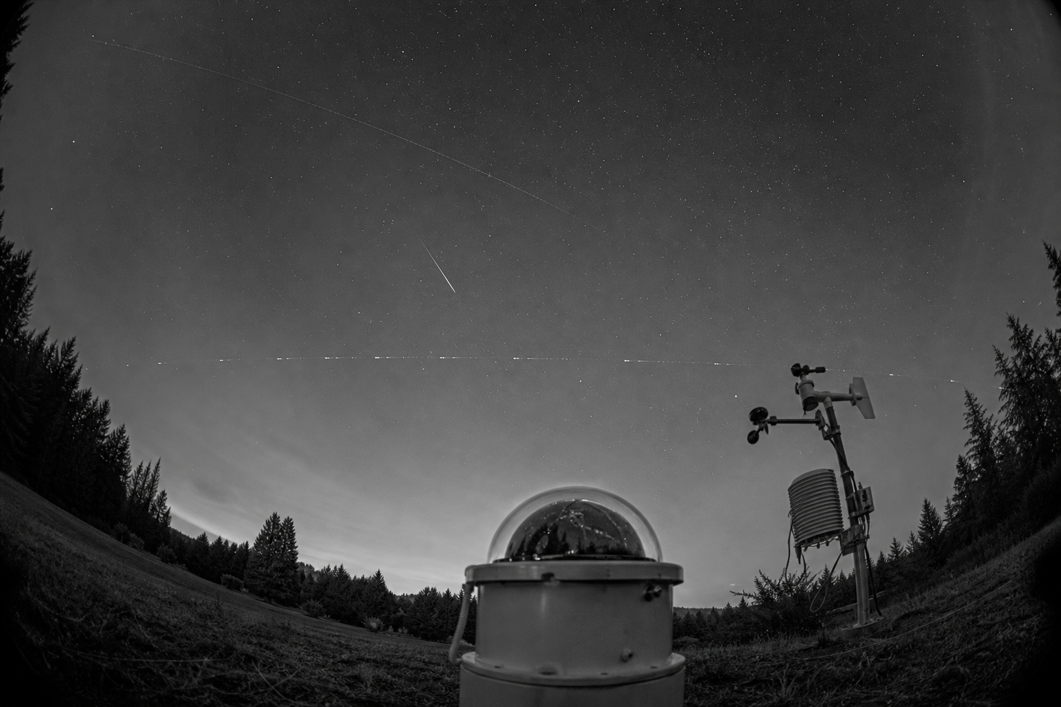
Other candidates arise closer to the camera than to the sky. Thin cloud, haze, halo effects around bright lights, reflections, insects crossing near the lens, raindrops, compression errors, hot pixels, and automatic exposure changes can all create shapes or apparent motion that invite an overly literal reading. These are not trivial possibilities: a near-lens insect may appear large and fast because it is out of focus, while a fixed sensor defect can seem to move when image processing or stabilization shifts the frame. The practical distinction is between a feature that persists in the raw imagery and one that changes with the camera or processing conditions.
Useful review therefore compares the record against independent context: meteor reports, satellite-orbit predictions, aircraft-position data where available, weather observations, local light sources, and records from another viewing location. A visually striking clip that lacks a reliable time or location cannot be tested against those reference points. By contrast, an anomalous aerial observation with preserved timing, direction, and matching external data may support an ordinary identification, or narrow the remaining possibilities. Neither outcome turns UAP sightings or UFO sightings into evidence of an unusual origin; it makes the classification process more accountable.
No supplied primary material describes AllSkyCAM’s own exclusion database, review rules, or published identified cases. It would be premature to claim that the project currently performs any particular cross-check automatically. The value of the approach lies in what a sufficiently documented optical record can make possible, rather than in visual impression alone.
What Evidence It Can Produce, and What It Cannot Prove
Evidence gains weight through traceability rather than visual drama. At the top of the hierarchy is a preserved original file linked to a known camera position, accurate timestamp, calibration record, and complete metadata. Calibration ties pixels and brightness to the instrument’s known behavior; metadata records the circumstances of capture; preserving the original permits later reviewers to distinguish sensor output from edits, recompression, or stabilization. These are core elements of UAP data quality.
A second synchronized station materially changes the inference. If separated cameras record the same event, their independent lines of sight can be compared to constrain its geometry. Corroborating information, such as a weather record, astronomical reference, aircraft track, radar return, or another sensor type, does not automatically identify an object, but it can test a proposed explanation. This is the standard toward which scientific UAP investigation should aim: records that another analyst can inspect, reproduce, and challenge.
At the bottom sits an isolated social-media clip: often copied, cropped, filtered, stripped of location and timing, and detached from the original file. It may document that someone saw something, but usually cannot establish where the event occurred or how far away it was. A bright point can look fast because it is near, or large because it is distant; without range, apparent angular motion is not a measured speed.
Optical imagery alone may therefore leave size, distance, velocity, material, intent, and origin unresolved. “Unidentified” describes the state of the available record, not an extraordinary conclusion. It is not proof of non-human intelligence, an extraterrestrial craft, crash-retrieval claims, or a government UFO cover-up. For UAP research, the responsible outcome is sometimes a narrower statement: the observation remains insufficiently constrained for identification.
Why AllSkyCAM Matters to the Broader Study of UAP
The wider value of an all-sky effort lies in turning a transient report into a record that can be revisited by people other than the original witness. Repeatable monitoring creates the possibility of comparing events across nights, sites, instruments, and proposed explanations rather than treating each sighting as a self-contained mystery.
For Germany UFO research, that changes the standard of discussion. A useful case file would make clear what was recorded, when and where the instrument operated, what processing was applied, which ordinary explanations were tested, and why any residual uncertainty remains. Transparent methods allow critics to find errors, supporters to test the same interpretation, and later analysts to reprocess preserved material as better reference data or techniques become available.
Public release of original records, calibration information, event logs, and negative results would strengthen that model where privacy and operational constraints permit. Open data does not guarantee a solution; it makes the path from observation to conclusion inspectable. A documented “likely aircraft” or “insufficient data” result is scientifically more useful than an impressive clip accompanied only by an assertion.
This is also why AllSkyCAM should not be treated as a vehicle for UAP disclosure or UFO disclosure narratives. Its potential contribution is evidentiary, not political: a disciplined archive can reduce avoidable ambiguity while preserving the smaller set of cases that genuinely resist identification. International UAP research benefits when observations can be challenged across borders using shared timestamps, methods, and case criteria rather than anecdotes, reposts, and isolated interpretations.
No supplied primary material establishes that AllSkyCAM currently publishes datasets, technical reports, or a case archive. Those absences are consequential. Until such material is available, its broader importance is best understood as the standard an evidence-first observing program should meet, not as proof that the standard has already been met.
How to Report a Potential Observation Responsibly
Begin by protecting the record before trying to interpret it. Keep the original photo or video file on the device and make a separate backup; do not trim, filter, stabilize, add captions, or upload only a recompressed social-media version. An original file can retain timestamps, location data, device details, and frame sequence that a repost may discard.
- Write down the exact local time, your observing location, and the direction of travel or bearing; “over Berlin” is weak, while a street-level location, time, and “moving east from southwest” gives analysts usable reference points.
- Record duration, apparent brightness or colour changes, sound, cloud cover, wind, visibility, and nearby lights or landmarks.
- Preserve additional material: unedited follow-up images, screenshots of relevant weather or flight information, and notes made immediately after the event.
- Ask other witnesses to create their own accounts and retain their own originals. Independent observations are more valuable than copies of one clip.
- Separate observation from inference: describe what was seen before proposing aircraft, drone, meteor, or other explanations.
No current official AllSkyCAM reporting address or submission route has been established in the material available for this article, so readers should not assume that a social-media tag or similarly named account reaches the project. Reporting a potential observation responsibly means preserving original material and recording the circumstances clearly. Reports to emergency, aviation, meteor, or local authorities serve different purposes and are not submissions to AllSkyCAM. Careful records help resolve ordinary cases quickly while preserving the smaller remainder for meaningful further analysis.
What AllSkyCAM Shows About Evidence-First UAP Research
The practical standard is not whether an image looks striking, but whether another investigator can reconstruct the observation and test competing explanations. A calibrated camera gives measurements a stable reference; complete metadata anchors the file in time and place; and an independent second view can turn an apparent motion into a constrained path rather than a visual impression.
That distinction changes the value of a report. A lone clip of a bright point may remain ambiguous because glare, focus, exposure, and perspective can mimic unusual behaviour. The same event becomes far more useful when its original file, observing position, clock information, weather context, and comparison records are retained. It may then match an ordinary source, or remain unidentified for specific, documented reasons.
This is the durable lesson of the Germany AllSkyCAM UAP research program as an evidence-first model: identifying a likely meteor, aircraft, satellite, drone, or optical effect is a productive result, not a failure of investigation. Filtering such cases prevents the unresolved remainder from being defined by avoidable uncertainty.
Preserve unusual observations carefully, seek independent corroboration, and keep the description separate from the interpretation. If the available record still cannot support an identification, the appropriate conclusion is unresolved, not proven extraordinary.
Frequently Asked Questions
-
What is Germany’s AllSkyCAM UAP research program?
AllSkyCAM is a proposed all-sky observation effort for preserving and assessing unusual aerial observations. Available records do not establish it as a German government program, military operation, or official national UAP investigation service.
-
Is AllSkyCAM an official German government UAP program?
No documented primary material identifies a German federal ministry, Bundeswehr unit, national UAP office, or government operator for AllSkyCAM. Its operator, funding, station locations, and partner organizations remain publicly unresolved.
-
How can all-sky cameras help investigate UAP sightings?
A fixed, calibrated all-sky camera records a broad area of sky with precise timestamps, station coordinates, and original files. Two or more separated stations with synchronized clocks can compare independent sightlines to constrain an event’s position and trajectory.
-
What technical information should an all-sky UAP camera record include?
Useful records include the original image or video file, accurate timestamp, surveyed camera location, calibration data, metadata, and details of any processing applied. Camera model, lens field of view, capture cadence, clock source, and lens-distortion calibration are also important for evaluating measurements.
-
What should I look for before treating a UAP video as strong evidence?
Choose records with preserved originals, exact time and location, fixed reference points, calibration, and an independent second view where possible. Compare the observation with meteor reports, satellite predictions, aircraft data, weather conditions, local lights, and possible camera artifacts before concluding it is unexplained.