The 2013 infrared video recorded near Aguadilla, Puerto Rico, became one of the most persistent modern claims of a transmedium unidentified anomalous phenomenon. To an unaided viewer, a dark thermal shape seems to race across the landscape, separate into two forms, and vanish as the ocean fills the background. That visual sequence is compelling. It is also a textbook example of why imagery cannot be interpreted reliably without the observing platform’s motion, sensor angle, range, weather, and thermal behavior.
In March 2025, the All-domain Anomaly Resolution Office published a seven-page case resolution and an animated Systems Toolkit reconstruction. AARO reached two conclusions at different confidence levels. It assessed with high confidence that the objects did not display anomalous speed or transmedium capability. It assessed with moderate confidence—not high confidence—that the objects were a pair of sky lanterns. Preserving that distinction is essential: the behavior was resolved more strongly than the exact identity.
The recording and the original appearance
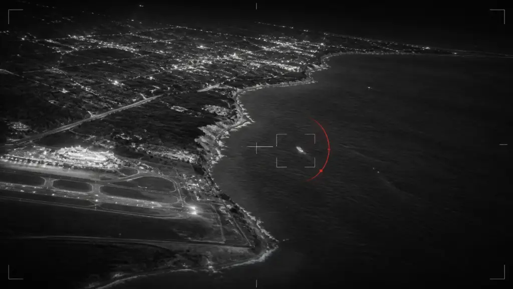
On April 26, 2013, an infrared sensor aboard a U.S. Customs and Border Protection De Havilland Canada Dash 8 aircraft recorded the event above Rafael Hernández Airport. AARO says the aircraft flew in an arc around the airport while climbing about 1,725 feet, ultimately losing sensor contact at an aircraft altitude of 3,600 feet. The range between the aircraft and the objects nearly tripled. Scattered clouds at about 3,000 feet also crossed the viewing path. These are not incidental details: a moving aircraft, changing look angle, increasing range, zoom, clouds, and automatic thermal display adjustments can substantially change what a small target appears to do.
The official DVIDS release preserves the 3-minute, 54-second video and describes the initial impressions plainly: high speed, apparent separation, and apparent movement into or out of the water. Those are observations about how the footage looks, not verified measurements. AARO’s task was to determine whether the underlying geometry required those interpretations. Readers can compare the source video and reconstruction directly, consistent with our primary-source review process.
Reconstructing speed and path
AARO reports that a Systems Toolkit reconstruction combined the aircraft’s known position with sensor parameters including elevation, azimuth, and slant angle. It placed the objects near the northeastern side of the airport at approximately 200 meters, or 656 feet, above ground. The reconstructed path ran southwest in a straight line over land. The estimated speed was about 3.6 meters per second, or 8 miles per hour, close to the recorded east-northeast wind of approximately 4.4 meters per second, or 9.8 miles per hour.
This finding addresses the apparent speed through motion parallax. When an observer moves rapidly relative to a slow or stationary target, the nearer landscape and the target can sweep across the image at different apparent rates. Zoom and a narrow field of view remove many of the visual cues that help a viewer judge distance. In the Aguadilla footage, the aircraft’s motion and orbit created a strong impression that the object was traversing the ground quickly. Once AARO reconstructed the sensor line of sight, it found a slow path consistent with drifting in the wind.
AARO also examined frames where the objects seemed to pass behind a utility pole, an interpretation that would imply a much lower and faster target. Pixel analysis did not support an actual passage behind the pole. AARO cautioned that pixel analysis alone could not determine altitude or trajectory, so it used the result only as a constraint within the broader geometric reconstruction. That layered method—testing a local image claim, then combining platform and sensor data—is more informative than estimating speed from the video alone. It aligns with the principles in our guide to evaluating UAP claims.
Why one object seemed to split
AARO concluded with high confidence that the video showed two objects traveling close together, not one object dividing or replicating. The report identifies visible separation multiple times within the first minute, including around 29.56, 40.76, and 47.00 seconds. As the aircraft climbed, the sensor’s view changed from a lower side angle toward a steeper, more top-down perspective. Two nearby objects that overlapped at one angle became easier to distinguish at another. Increased magnification made the late separation look more dramatic.
This explanation is testable against the footage. It does not ask the viewer to accept that an object physically duplicated. It predicts that brief separations should appear before the most famous moment—and AARO points to those earlier frames. The reconstruction therefore converts an extraordinary-looking event into a changing line-of-sight problem without denying that the visual effect is striking.
Why the objects seemed to enter the ocean
The transmedium interpretation depends on the assumption that the objects followed the background coastline into the water. AARO’s reconstructed line of sight placed them over land for the entire observation. As the aircraft’s orbit brought the ocean into the background, the objects’ infrared contrast weakened until the sensor could no longer separate them from their surroundings. In other words, the background changed; the reconstructed target path did not cross the shoreline.
The report identifies thermal crossover as a contributing effect. Thermal sensors display differences in infrared radiation, not ordinary visible color. When a target and background approach the same apparent temperature, the target can fade, disappear, or intermittently reappear. AARO notes that sunset occurred at 7:48 p.m. local time and the recording was made at 9:22 p.m., within a period when post-sunset thermal crossover can affect imagery. Increasing distance and intermittent cloud cover further reduced fidelity. None of these effects means the sensor malfunctioned. They describe limits inherent in discriminating a small, low-contrast target.
Why AARO favors sky lanterns
Pixel comparison led AARO to estimate that each object was smaller than one meter, or about three feet, though their shapes remained indistinct. Their straight, wind-speed path, small size, and fluctuating thermal signatures fit sky lanterns. The office also reported confirming with local hospitality vendors that hotels and resorts in the area commonly release lanterns during celebrations. A fuel source in a lantern can produce a flickering thermal signature that weakens as the fuel is consumed.
But the identification is not categorical. AARO explicitly reduced its confidence because of poor video quality. It considered other hypotheses. A partner proposed marine birds moving much faster and eventually descending to the ocean; AARO rejected that path because its reconstruction kept the targets slow and over land, and because the imagery lacked recognizable wing-beat features. Another partner favored tied Mylar balloons and suggested reflected moonlight might explain the changing infrared return. AARO agreed that balloon-like drift was plausible but did not accept reflected moonlight as a likely infrared mechanism. These disagreements show that a resolved performance claim can coexist with uncertainty about object type.
What the case resolution can and cannot prove
AARO’s strongest result is geometric: the available sensor and platform data were sufficient, in its assessment, to rule out anomalous speed, physical splitting, and water entry with high confidence. The sky-lantern attribution remains moderate confidence. The report does not provide all raw telemetry, every model input, or the full work of its Intelligence Community and science-and-technology partners in a reproducible public package. Independent analysts can inspect the released video, report, and reconstruction, but they cannot rerun every step from the published material alone.
That transparency limit does not invalidate the resolution, but it should remain visible. AARO also states that its report is not finished intelligence and may incorporate partner information to support its analytic view. The appropriate conclusion is therefore neither “transmedium craft proven” nor “every detail independently settled.” It is that the official analysis provides a coherent, data-based explanation for the apparently extraordinary behavior, while the precise mundane identity remains probabilistic.
The case fits a larger pattern in AARO’s resolved portfolio, where platform movement and sensor effects can generate dramatic appearances. It should be read alongside our coverage of AARO Director Jon Kosloski’s 2024 Senate presentation, where the Puerto Rico reconstruction was publicly summarized, and the site’s evidence topic cluster. The enduring lesson is methodological: impressive imagery is evidence, but the image is not a complete measurement system.
Sources
- AARO: Puerto Rico UAP Case Resolution
- AARO: November 2024 Senate hearing case slides
- DVIDS: official Puerto Rico objects video
- DVIDS: AARO Systems Toolkit reconstruction
- AARO: UAP Case Resolution Reports index